Surroundings
a tour guide to the surrounding area
NanJi Camping Ground
· Address : 162 , Hangang Nanji-ro, Mapo-gu, Seoul (487-116, Sangam-dong)
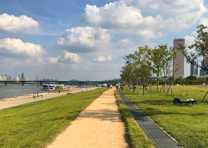
The 4.02 km-long (approximately 776,000 ㎡) Nanji Hangang Park sits on Sangam-dong, Mapo-gu and is located between Hongjecheongyo and Nanjicheongyo. Developed as part of the Hangang Renaissance Project, the Park offers better access to the public by completing the central connection bridge to Noeul Park and Haneul Park, connection bridge to Peace Park, and complex connection passages.
Mirror Fountain in front of the connection bridge to Peace Park mesmerizes visitors with a breathtaking view of water, sending up a column like a rainbow and serves as the landmark of Nanji Hangang Park. The riverside water play area is as deep as 80 cm, which reminds of the old playful days on the riverside, is a great place for children to get all soaked up and enjoy the playing in the water. Visitors can cross the pedestrian connection bridge to see the grassland in its most natural form as well as the plant communities at waterside of the Ecological Wetland Center. The nearby camping site is a popular destination for the public to enjoy barbeque and camping. The bike lane is connected to Ttukseom Park to the east and southern side of Haengjudaegyo in Goyang-si as well as to Noeul Park and Haneul Park to the west. Come and relish in the pristine natural beauty of Nanji Hangang Park.
View more map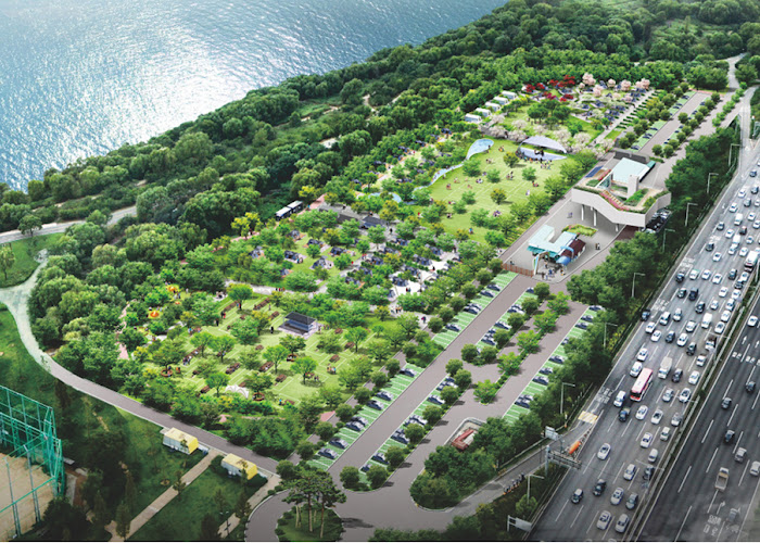
Mangwon Hangang Park
· Area : 422,347㎡ ( Bamseom 244,417㎡ excluded )
· Length : 7.4㎞ (Manchocheon-gyo ~ Hongjecheon-gyo)
· Address : Maponaru-gil 467, Mapo-gu, Seoul (Mangwon-dong 205-4)
· Mangwon Information Center : ☎ 02)3780-0601
Mangwon Hangang Park, which houses Seoul Battleship Park, is a park that is visited by more than 3 million citizens every year. It provides a green place to rest with facilities such as a soccer field, a basketball court, a volleyball court, a baseball field, a lawn field, a bicycle path, and an outdoor swimming pool (in summer).
Located at the northern end of the river between Wonhyodaegyo(bridge) and Seongsandaegyo(bridge), Mangwon Hangang Park is adjacent to Mapo-gu. The park includes a wide lawn field by the river, which is home to a well-structured seating area with a walkway. This area is also a staging area for various water activities such as windsurfing, water skiing, and motor boating. In addition, there are cultural remains on site such as Mangwonjeong(pavilion) and Jeoldusan Martyrs' Shrine. Connected to World Cup Stadium and Incheon International Airport, Mangwon Hangang Park possesses unlimited potential as a strategic hub in the western part of Seoul.
View more map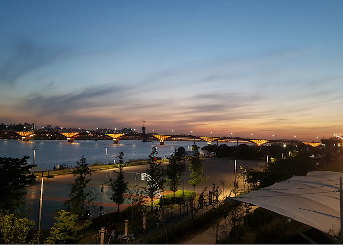
Manglidan-gil
· Address : 403-7, Mangwon-dong, Mapo-gu, Seoul
Enjoy the exotic atmosphere of the restaurants and cafes and the simplicity and nostalgia of the traditional market at the same time.
It is said that Malidangil is a distinctive street with unique and romantic restaurants, cafes and shops, which is reminiscent of Gyeongnidangil, Itaewon.The name, ‘Manglidangil’ is a combination of Mangwon-dong and Gyeongnidan-gil and is loved by many people.
map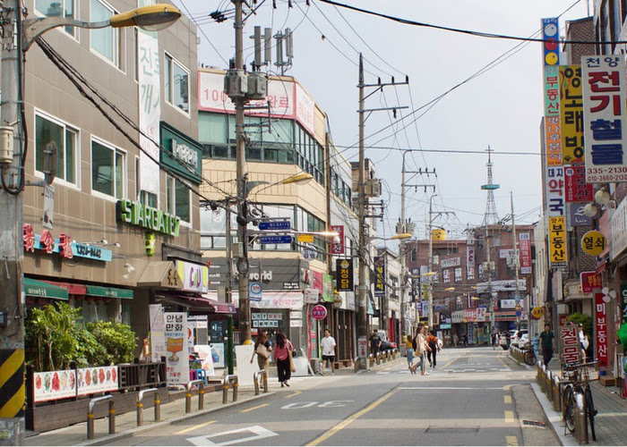
Mangwon Market
· Address : 14 Poeun-ro 8-gil, Mapo-gu, Seoul
Mangwon market is a traditional market that is constantly communicating with citizens through cheap and delicious food and a range of events.It is an impressive place with many famous restaurants and steady management, as well as the atmosphere of a fascinating market.
map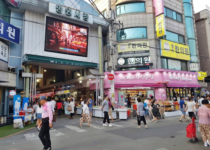
Gyeongui Line Forest Park (Yeontralpark)
· Location : Yeonnam-dong, Mapo-gu- Subway : Line #2, Hongik Univ. Exit 3 of Airport Railroad and 7-minute
Ginkgo Road runs along the old railway tracks, like Central Park in New York, Yeontralpark!
Not only does Ginkgo road run along the old railway line, but it also includes a pond and small flourishing places everywhere. Endless green lawns invite people to enjoy the relaxing atmosphere. It is also called " Yeontralpark " because it is so beautiful and is comparable to Central Park in New York.
map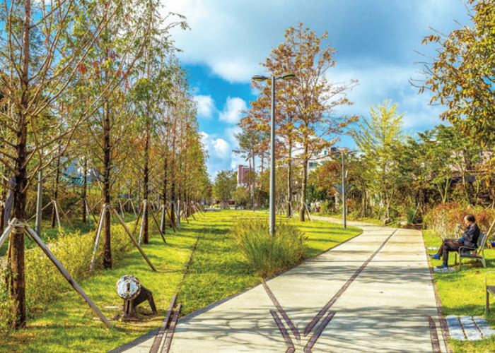
Hongdae Street
· Subway : Exit # 9, Hongik Univ. Line 2
A young and romantic street where culture and art, in a variety of genres, are mixed together.
This is an inarguably hot place in Seoul, represented by youth, romantic art, underground culture, freedom, independent music, painting and design. It is also famous for its art market, range of restaurants, unique cafes, small galleries, boutique and exclusive fashion shops and live cafes and clubs.
The galleries and beautiful cafes that spread out from the main gate of Hongik University attract young people as well as art majoring students of Hongik University to the point where the street has evolved into the 'Street of Youth' that represents Seoul.
map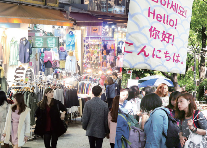
Mangwonjeong
· Address : An-gil 23. Dongyo-dong 8, Mapo-gu, Seoul
· Subway : Exit #2 of Mangwon station (line 6) and 15 min of walk to Mangwon Hangang Park
· Information Center : ☎ 02-3153-8350
In the 15th year of King Seongjong (1484), Wolsan-gun, who gave up his throne to his brother, built a pavilion and named it Mangwonjeong.
Located at 457-1, Hapjeong-dong, Mapo-gu, Mangwonjeong was built in the 7th year of King Sejong (1425). This pavilion was the cottage of Hyoryung-gun, the second son of Taejong. It was originally called Huiujeong. The origin of the name is as follows. After building the pavilion, King Sejong went to Mohwagwan(recepting building for envoys) and took a look at the farming situation of the people there. They were worried because it had not rained for a long time. Finally, rain came down. So King Sejong named the pavilion Huiujeong, meaning ‘a pavilion where a nice rain comes down.
After that, in 1484, Wolsan-gun, who conceded the throne to his younger brother, renovated the pavilion and named it Mangwonjeong. From this pavilion, Sanyu Peak rises to the south across the river, and in the north there is a Yeonheebul(Yeonhee plain)spreading straight, making the scenery very beautiful. King Sejong often visited the pavilion to watch military exercises that were held in Yeonheebul and invited envoys from the Ming dynasty to enjoy the scenery. It was restored in 1989 by the Seoul Metropolitan Government and designated and managed as the Seoul Metropolitan Monument No. 9, which was lost in the flood of 1925, and the Han River development project.
map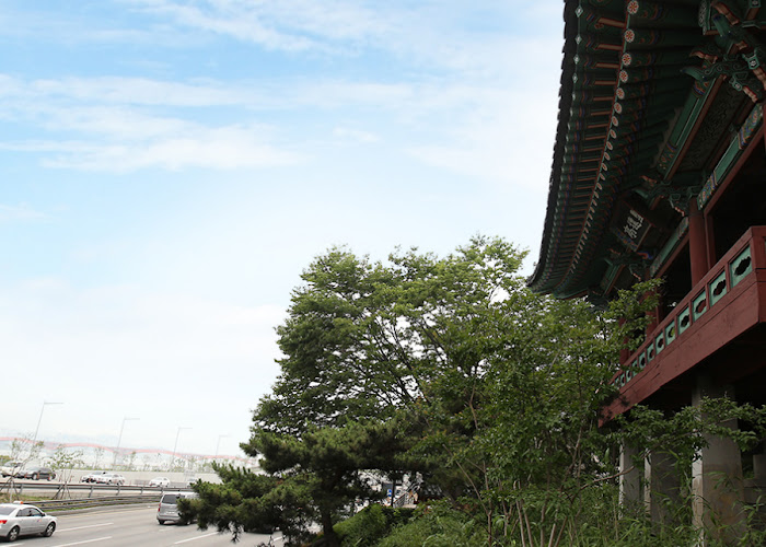
Seonyudo Park
· Address : 343 Seonyu-ro, Yeongdeungpo-gu, Seoul
On Sunyu Island, which is called "Water Park," visitors experience the ecology, culture and history of the Han RiverA unique place to see the Han River from within the Han River
The small island on the Han River, which has a small hill called Sunyoungbong, and the freshness of which is enjoyed by tourists, has become one of the key landmarks of Seoul. Seonyu Park, which is an ecological park and the first water park in Korea, is a unique place to experience the ecology, culture and history of the Han River and to see the Han River from within the Han River. It is even more beautiful in the evening when you can see the night view of Seoul.
map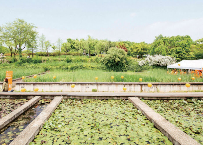
Jeoldusan Martyrs' Shrine
· Address : 6 Tojeong-ro, Mapo-gu, Seoul
· Operating Hours : [Jeoldusan Martyrs' Museum] 09:30~17:00 (except holidays)
· Closed : [Jeoldusan Martyrs' Museum] every Monday
· Information : ☎ 02-3142-4434
This is a sacred place where the spirit of Korean Catholic martyrs, who sacrificed their lives, is alive. Yanghwajin is also famous for its beautiful scenic spot with Jamdubong, where many people of taste and writers alike enjoyed the twin pursuits of poetry and boating.
In 1866, after the proclamation of the Catholic repression, nine of the twelve French missionaries in the land were killed in the months leading up to the eventual death of more than 8,000 Catholics. Meanwhile, the government was looking for the three outstanding French priests who were still unaccounted for. This circumstance led women and children to flee to the mountains where many succumbed to disease and famine. Priest Félix-Clair Ridel, who succeeded in his escape, got word of the repression to Pierre-Gustave Roze, a French admiral. French warships then entered the Yanghwajin and Sogang areas of the Han River to oppose the repression. Daewongun, who was furious about the situation, beheaded a number of Catholics at Jamdubong, giving the mountain the name Jeoldusan, which is a Korean term meaning, ‘to cut the head.’ The Catholic Church of Korea opened a Martyr's Memorial Hall in October 1967 in commemoration of the 100th anniversary of the martyrdom of the Byungin year, 1866.At present, there are archives related to the Catholic Church in Korea, an exhibit hall housing 28 bodies of saints, a pilgrimage hall, a martyr education hall, and an outdoor exhibition hall in the shrine. Jeoldusan Martyrs' Shrine is a meaningful sacred place where the spirit of the Korean Catholic martyrs, who proved their faith by giving their lives, is still alive.
View more map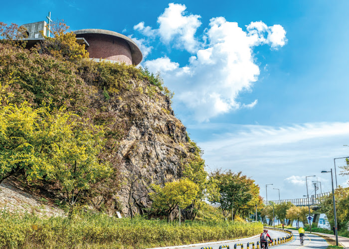
Bamseom
· Address : Yeouido-dong, Yeongdeungpo-gu, Seoul
· Information : ☎ 02-3780-0793
It is famous for being a habitat of migratory birds, and is located at the pointwhere the bridge of Sogang University crosses the Han River, downstream of Mapo Bridge. It is famous for migratory birds, and is located at the point where Sogang Bridge crosses the Han River, downstream from Mapo Bridge. Bursum was named after its shape, which is a chestnut.
Originally, it was an isolated island, but as Yeouido developed into an increasingly wide island, it started to connect when water levels were down. The bedrock is a solid rock layer, and the east and west side of the island, Hasikae (River Cliff) is called “Little Hagum River” because the scenery is breathtaking. The total area of the island is 241,490㎡ and the elevation is 3.0 ~ 5.5m above sea level. The area of the island is increasing every year due to sediments. The island is mostly underwater when discharge from the Paldang dam exceeds 5,000 tons, or during flooding. Its reefs are mostly filled with mud, sand and gravel.
map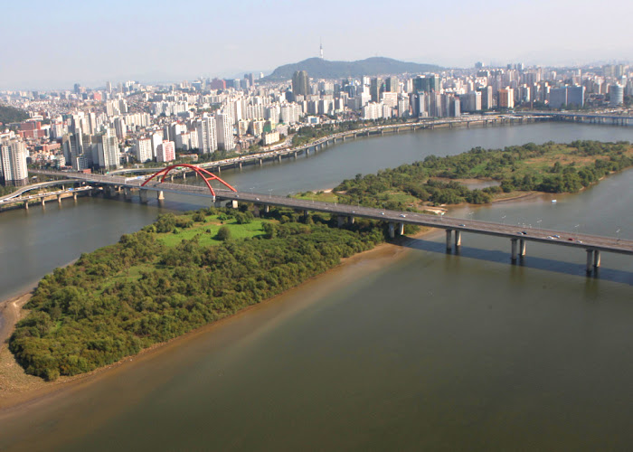
Yeouido Hangang Park
· Address : Yeouidong-ro 330, Yeongdeungpo-gu, Seoul
· Information : ☎ 02-3780-0561
It is a relaxation area with lots of attractions to see and enjoy. Yeouido Hangang Park is located in Yeouido, the center of politics, finance, and media in Korea. It is accessible by public transportation, either by subway or bus, and is a favorite place for businessmen and ordinary citizens.
This is a relaxing place where there are a lot of things to see and do such as experience the spring flower festival, watch the world fireworks festival, enjoy various performances and participate in marathon events. In addition, Bamseom and Yeouido Saetgang Ecological Park are eco-friendly parks in the natural environment making them ecological learning centers.
View more map